|
Ethan's Ark Voyages |
| Home Dunedin to Chesapeake Oct., 2008 Hampton to Florida Oct., 2009 Florida to St. Mary's County April, 2010 St. Mary's County to Florida Oct, 2013 Hudson to Bahamas and Back June, 2017 Contact Us |
Trip
From Tall Timbers, Md., to Hudson Fl.
During 2013, Mary and I had decided that this would be my last year working full time and we would be heading to Florida. In May of 2013, we found a house on a canal in Hudson, Florida purchased the house, and we plan this to be our home-base for the next few years while we cruise in the Theodore Robert. In July we packed up the apartment in Lexington Park and moved all of our nonessential worldly goods to the house in Hudson and moved aboard the Theodore Robert with everything else, including Buoy the Schipperkie and Mist the cat.
In September, Mary took her car to Hudson and flew back. This meant we would have transportation when we arrived at our destination. We originally planned to leave at the beginning of October; however, I delayed my retirement/resignation until October 11th, with the hope that I would be laid-off the beginning of the federal fiscal year. Being laid off would mean more dollars in my pocket; however, this was not to be. I submitted my resignation at the end of September and we were committed.
Earlier in the year, our friend JimBob Kendall had volunteered to travel with us from the beginning of October until October 30th. when he needed to be back in Florida for his volunteer work, working with high school students learning robotics. As it turned out, we only had JimBob with us for two weeks due to the delay in departure. JimBob took the train to Alexandria Virginia where I picked him up on Sunday morning, October 13th. Sunday afternoon and Monday morning were a blur of activity as we prepared to get underway. We said our goodbyes and cast off our lines at 1230 hours, Monday, 14 October, 2013.
Day1: Monday, 14 October, 2013.
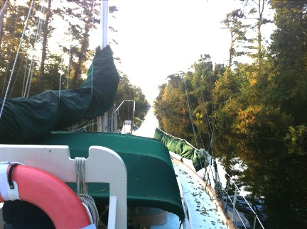
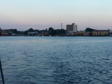
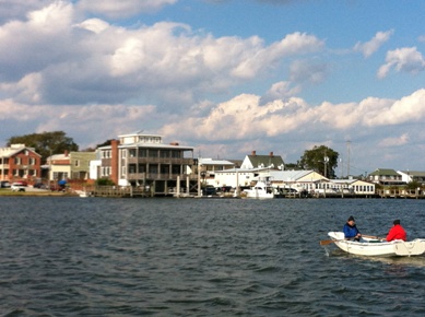
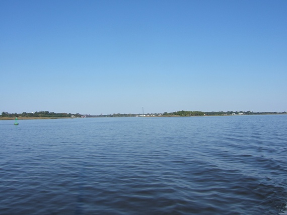
We left Herring creek and turned south down the Potomac River with a NE wind blowing20 knots with a heavy chop. It was good sailing weather; but I had hurt my back on the day before we left, and JimBob and Mary are both relatively novice sailors. This didn’t leave us with much in the way of capable crew to handle the sails. We decided to power along for the first day, so that JimBob and Mary could get acclimated to being underway, and perhaps my back would get better. When we entered the Chesapeake from the Potomac River we were in a significant beam sea and were rolling violently. It was not dangerous, but it was violent enough for Mary to get seasick. JimBob and I were fine, but decided to find the nearest safe anchorage. We made it to Ingram Bay, five miles south of the Potomac River, and headed up the Wicomico River about 2 miles where we found a nice sheltered anchorage just north of Sandy Point. We dropped the hook at 1930. Mary recovered nicely once we got into sheltered waters and prepared an excellent meal, and we turned in vowing to make better progress the next day.
|
|
|
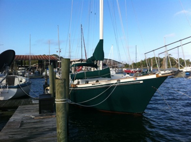
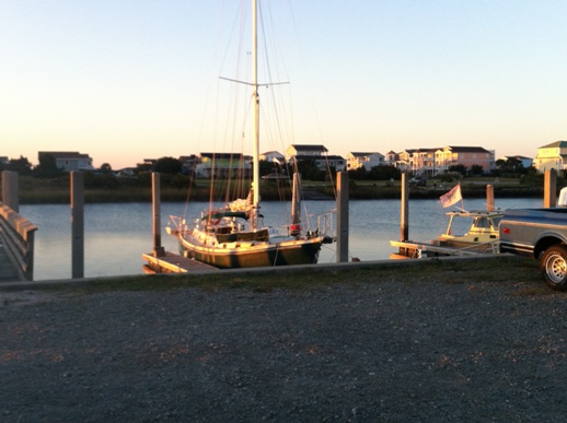
| 10/14 At Tall Timbers just prior to departure | 10/14 Leaving Tall Timbers | 10/14 Down the Potomac to the Chesapeake |
Day2: Tuesday15 Oct, 2013
On Tuesday morning we didn’t get underway until 0900. The weather was still very brisk and the next good anchorage was at Fishing Bay. Fishing Bay was only about 26 nautical miles away, and there was no hurry. We would have liked to go farther, but to reach other anchorages we had to go almost 10 nm west from our desired track. At our speed, that meant 2 hours out of our way to get to an anchorage and another two hours leaving the anchorage. The days were short and the weather was blustery and cold and we decided that having a short day was better than having a crew that felt miserable. Mary got sick again entering the Chesapeake, and that solidified our decision to stop at Fishing Bay. We arrived and set our anchor in Fishing Bay at 1520.
During the second day of the trip we encountered a strange problem when we tried to engage the autopilot. I have a Sitex hydraulic autopilot with a control head mounted to the pedestal and a separate handheld control head that I can plug in. The hand held control head is newer and somewhat more reliable so I typically plug in the handheld control head each morning and use it for controlling the autopilot. On Tuesday we went through our morning routine which includes plugging in the hand held autopilot control head. No problem. After we entered the Chesapeake and tried to engage the autopilot, it did not engage, and it had this cryptic message: ”hop.” We turned off the auto pilot, turned it back on and tried to engage it. Same cryptic message: “hop” What? Time to go get the manual. I turn the helm over to JimBob and go below to read the manual. No luck on the error codes. Hmmm? O.K., forget it for now, I figured I would check it out when we anchored. At anchor, I read the manual again. It turns out that “hop” means that the autopilot is in calibration mode and wants the operator to turn the wheel “hard over port.” OK, so how do I get out of this? I try turning it off and then back on, several times, if it doesn’t work the first time it might the second? NOT. I should know better. Anyway, the only way to get out of this calibration mode is to go through this particular part of the calibration procedure. “hop”, “hos” let the autopilot move the rudder, and at this point it lets you exit. JimBob and I figured that this had happened due to water in the socket for the hand held control head, shorting a couple of pins momentarily, and causing the unit to go into this calibration mode. We were wrong, but didn’t figure it out until several days later. Anyway we tested the autopilot at anchor and it seemed to be working fine.
Day3: Wednesday 16 October, 1013
Wwe manage to get underway at Fishing Bay considerably earlier than our previous day’s departure. We were underway about 0730 and headed for the Chesapeake. On entering the Chesapeake, we hoisted the working jib and headed for Hampton Roads. Again we tried to engage the autopilot and we had the same error as the previous day. Once again we wrongly guess that it is moisture causing the problem. There was nothing we could do about the autopilot while underway, so once again we bit the bullet and figured we would see if we could get it working once we were either at anchor or tied up. We had a pretty uneventful trip down to the entrance to Hampton Roads, then after passing close aboard Old Point Comfort at the entrance we noticed a freighter barreling up the channel into Hampton Roads. We kept well to starboard of the channel while ensuring that we did not end up on the Hampton Bar. We were considering making the turn to port to head up the Elizabeth River, but that freighter kept coming at about 15 kts, right into the harbor! We turned into his wake and buried the bow sprit as we went through the wake. He kept up speed while he made the turn into the Elizabeth River and was tied up in his berth near the mouth of the Elizabeth River well before we had even crossed the channel. I had intended to tie up at one of the free docks at the North Landing in Portsmouth; but we wanted to do laundry and get fuel, so we decided to bite the bullet and tied up at the Portsmouth Boating Center at 1720 on 10/06/2013. (I am trying to reconstruct the trip from the log book, and I find that I was very lax in ensuring that log entries were frequent and informative. Note to self: “Do better next time keeping the log!”
 |
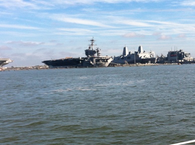 |
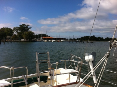
| 10/16 Down the Chesapeake with all the others | 10/16 Passing the Navy Yard at Norfolk |
Day4: Thursday 17 October, 1013
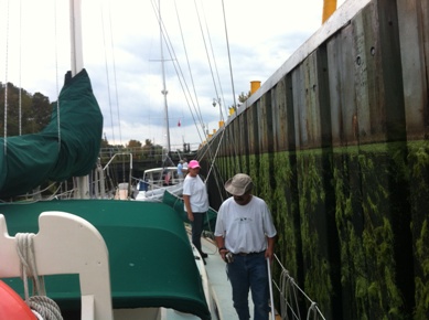
We departed Portsmouth Boating Center at 1000. The late start was due to finishing up laundry. (We noted some loss of coolant, and refilled the overflow tank. This was the only loss of coolant during the whole trip.) We arrived at the Deep Creek Lock (at the north end of the Dismal Swamp Canal) early for the 1330 opening and anchored to wait for the lock. There were four of us waiting for the southbound locking, and during our wait, a small outboard runabout with two locals cruised up to the locks, asked all of us our destinations, headed back north from the lock while making of show of finishing off their beer. O.K. so what? Well it was a little bit creepy, like the movie Deliverance on the intra-coastal! Anyway, the lock is delayed for mechanical problems and we don’t lock through until about 1600. This would be no big deal, except that we had planned on tying up at the Dismal Swamp Canal Welcome Center (18 statue miles from the lock) and there was no place to anchor in the canal. After the lock there was a thick bed of duckweed, and after passing through it we noticed that the engine was overheating a bit. We dropped the hook for long enough to clean out the strainer, about 15 minutes, but this was making us even later. Sunset was about 1845, and it didn’t look good for making the welcome center. We plowed ahead anyway but couldn’t make more that about 5.5 Knots due to the shallowness of the canal. The Dismal Swamp Canal is narrow, and shallow with lots of debris in the water. Travelling at night along this canal was not something that we wanted to do, but it was approaching night and we still had about five miles to go. We had checked earlier and “Active Captain” noted a free dock at approximately statute mile 17 of the intra-coastal water way. Just as night was falling, we saw the dock, pulled over and tied up as visibility went to a minimum. This dock is located at a partially completed roadside park, and there appears to be nothing around for miles. We did not see a single house, light or anything. Soooo, shades of “Deliverance”. Remember the two creepy locals at the lock? So did we. Before we went to sleep, we locked all of the hatches from the inside, grabbed what makeshift weapons we had and went to sleep with our makeshift weapons close at hand. (Paranoia hits everyone sometimes). All this turned out to be our overactive imaginations and we had no problems during the night.
 |
 |
 |
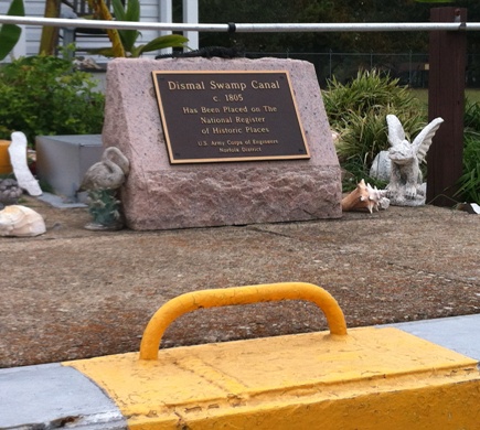
| 10/17 in Deep Creek Lock (Dismal Swamp Canal) | 10/17 Historical Marker Deep Creek Lock | 10/17 Leaving Deep Creek Lock |
Day 5 Friday, 18 October 2013
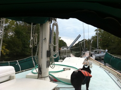
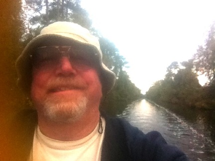
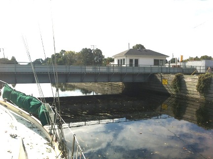
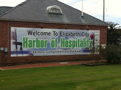
Day 5 was pretty uneventful. We locked through the South Mills Lock at 1100 and proceeded down Turner’s cut to the Pasquotank River. The Pasquotank had many patches of duckweed which we skirted around, and then when we arrived at the more open area of the Pasquotank, we once again went through the calibration procedure and restored the autopilot to operation.(Killed our way, and drifted while the autopilot went through its gyrations) (We Still have not truly identified the cause of the autopilot putting itself into calibration mode). We continue down the Pasquotank River to Elizabeth City and tie up at 1500. What a welcoming place! You can stay at the free city dock for two nights and don’t be surprised at how helpful everyone is!
There was an unintended good consequence of stopping to clear the strainer on the previous day. I have had a problem with the engine overheating slightly at high power and I just could not resolve this issue. Well, when we stopped to clear the strainer, I was below with JimBob at the helm and told him to up the RPM to 1600 to verify that the strainer was flowing freely. While observing the strainer, I noticed that the hose from the strainer to the engine had flattened out and restricted the flow! Eureka! Maybe this had been the problem all along. I had never before been below at high power observing the water intake lines! When we tied up in Elizabeth City, a gentleman who worked at the welcome center drove JimBob to a marine store which had wire reinforced hose. What a great place.
Here in Elizabeth City, just prior to heading out was when I discovered the real problem with the autopilot! I installed the remote control head for the autopilot and it immediately went into the calibration mode. I realized that the autopilot was on (in standby) when I plugged in the remote control head! Another eureka moment. We verified that this was the problem by going through the calibration sequence, turning off the auto pilot, removing the remote control head, reinstalling the remote control head, turning on the auto pilot. All good! Plugged in the remote control head while the autopilot was on, calibration mode. Cleared it once again and had the answer.
 |
 |
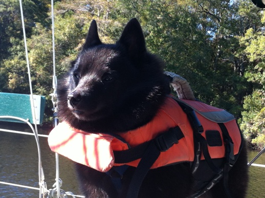
| 10/18 South on the Dismal Swamp Canal | 10/18 JimBob at the Helm |
 |
 |
| 10/18 South Mills Bridge, Just Before the Lock | 10/18 Arrived at Elizabeth City |
Day 6, Saturday, 19 October, 2013
We decided to take a lay day on the 19th. Mary needed some Dramamine and we all were a bit tired. The stress of my being at half capacity, Mary being sick, and JimBob being inexperienced, contributed to our exhaustion, and the free dock was a perk that made it well worthwhile to stay in Elizabeth City for a day. We were able to fill the water tanks, replace the intake hose, buy groceries and enjoy a good meal out on the town. The fact that the weather was still pretty nasty made the decision to stay an easy one.
At the city docks in Elizabeth City, there is no power so we ran the generator for hot water and to charge the batteries, and generally had a great lay day in Elizabeth City.
Day 7, Sunday, 20 October, 2013
On Sunday we were underway at 0730, with northeast winds 18 to 22 knots and a temperature of 66 degrees. We hoisted sail when we were abreast of marker 5A on the Pasquotank River and headed toward Albemarle Sound.
Once you get to Albemarle Sound, both branches of the intracoastal waterway converge at the Alligator River Bridge. The intracoastal waterway then continues via rivers and canals until it joins the Pamlico Sound from the Bay River, then proceeds up the Neuse River to Adams creek. The alternative is to head east toward Roanoke Island and if you can get under the 45 foot bridge from Redstone point to Roanoke Island you can head south through the Croatan Sound to Pamlico Sound then directly to the Neuse River and Adams creek. If you can’t get under the 45 foot bridge, the route takes you east of Roanoke Island through a narrow channel the length of Roanoke Island then out into Pamlico Sound. This is the route that I chose. Note that there is a whole discussion of the various routes with their pros and cons that I will not get into here.
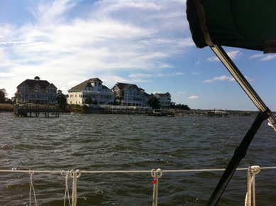
Mary had taken her Dramamine, and my back had healed by this point, and we were able to sail from Elizabeth City until we reached the channel that runs east of Roanoke Island. It was a broad reach under full sail, a great sail. The channel that runs east of Roanoke Island is narrow and winding, so we dropped sail and motored to the south end of Roanoke Island to Broad Creek, and tied up at the Broad Creek marina. There is not much available at Broad Creek but they have nice floating docks, fuel, water, and a small convenience store. We tied up at 1530, we had a great run this day, and bedded down for the night.
 |
 |
| 10/20 Leaving Elizabeth City | 10/20 Along the North Side of Roanoke Island |
Day 8, Monday, 21 October, 2013
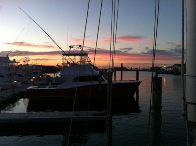
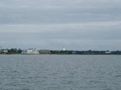
We got underway at 0800 and headed toward Okracoke Island under fair skies and light winds. Once we cleared the narrow channel and entered Pamlico Sound we hoisted the Genoa and motor-sailed to Okracoke. This was one of our more uneventful days. It was a beautiful trip down Pamlico Sound with little boat traffic, and gorgeous weather. We powered into Okracoke harbor and tied up at the park service dock for the night at 1730. We were late in the season and the whole town was pretty much shut down by the time we arrived. We settled in for a comfortable night with power, water, and restrooms available.
 |
 |
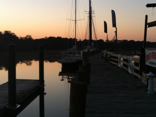
| 10/21 Sunrise at Broad Creek | 10/21 Approaching Okracoke |
 |
 |
| 10/21 Arrived at Okracoke | 10/21 Okracoke Ferry Landing |
Day 9, Tuesday, 22 October, 2013
We got underway at 0730 and headed out across Pamlico Sound and up the Neuse River to Adams Creek then down the canal to Morehead City. The winds started out at 6 to 10 knots; then faded away as we headed up the Neuse River. On this leg we were out of sight of land on Pamlico Sound. This was a first for Mary and JimBob. We cruised into Morehead City and docked at the Morehead City Yacht Basin at 1730. We had been underway for ten hours and were too beat to enjoy Morehead City.
 |
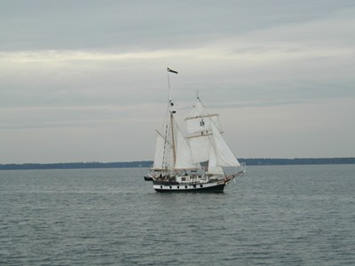 |
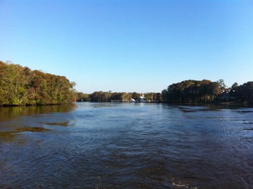
| 10/22 JimBob all bundled up leaving Okracoke | 10/22 a Spray schooner heading down the Neuse to Okracoke |
Day 10, Wednesday, 23 October, 2013
We decided to anchor at Swansboro, N.C. because I really didn’t want to anchor at Mile Hammock Bay. This made the day a very short travelling day. We left Morehead city at 0930 and anchored near Swansboro at 1350. Swansboro is a very friendly place and they are planning on installing some floating docks for transients. We rowed ashore and walked around Swansboro a bit and found it to be quite charming. That evening as we were topside running the generator to heat some water for showers, Buoy started barking at the engine room from topside. I figured something was wrong, so I went below to the engine room and found we had an exhaust leak and the engine room was filling up with fumes. I shut down the generator, and we let below decks air out, but that was the end of using the generator for a couple of weeks until I could get the exhaust repaired.
 |
 |
| 1023 Swansboro | 1023 Mary and ethan going ashore at Swansboro |
Day 11, Thursday, 24 October, 2013
This day was to prove to be the worst day of the trip for me. When you, as the Captain of the vessel, make a bad decision that costs money, time and frustration; it makes for a bad day. The day started off well enough, we were underway at 0730 and made our way south through all of the funky timed bridges, shallows, and inlets with their changing currents. We arrived at the Wrightsville Beach bridge just after their 1500 opening and had to wait around for almost an hour in the narrow channel for the 1600 opening. Here is where I got careless! As a rule, when travelling, or hanging around a narrow channel, I always stay to the windward side of the channel. If you do this, and you go aground, as long as you are not hard aground, the wind and the wakes will bounce you back towards the channel and with any luck, you will be back in the channel on your own! I ignored this basic tenet, and on one of the maneuvers to keep from drifting into the bridge or other boats, I ran aground on the leeward side of the channel, just as the tide had started out! The wind, and the wakes of all the passing boats, pushed us further and further into the mud. We were really hard aground before we could even think about getting and anchor down or anything else. After screaming incoherently at nothing in frustration, I settled down and decided that there was no way I was going to get myself off this time. It was near high tide and the wakes and wind had driven us harder aground. Waiting for the next high tide would probably not be enough to get us off. This was a first for me. For the first, and I hope the last time, I called a towing service to pull me off so that we could get to an anchorage before nightfall. The towing service guy seems to know what he is doing. He certainly says he does often enough. He attempts to pull my 38,000 pound full keel sailboat sideways out of the mud. The first thing that happens is that my 4X4 oak bit breaks off at the deck. Oops. My fault and his. I did not ensure that the load was spread between the two bits, and that the line was attached to the bottom of the bit. He did not tell me that he was going to pull sideways with that much force. There was a lot of force on that bit. I had always had confidence that these 4X4 oak bitts would handle anything, but now I know better. He claimed that it must have been rotten, but no, it was sound. There was just so much force it snapped. He continues to try to get me off by using his prop wash to try to free the keel. Nope!. Finally he decides to try to pull her off by the stern. O.K. this works. The Theodore Robert slowly starts to slide aft, and then we are free. (I tried to suggest this approach from the start, but he knew best). Anyway, he pulls along side and for the hour or so he had been working at getting me off, which should have taken about ten minutes, I was charged $700.00! Wow! Good gig if you can get it. Lessons learned, STAY ON THE WINDWARD SIDE OF A NARROW CHANNEL!! GET YOURSELF OFF!!
We finally get through the bridge at their 1800 opening, and now it is starting to get dark. We go the long way around to Wrightsville Beach and anchor in a crowd, but near the dinghy dock. We row Buoy ashore so he can take care of business, then crawl into bed exhausted.
No one took pictures this day! This surprises me, but so it goes.
Day 12 Friday, 25 October, 2013
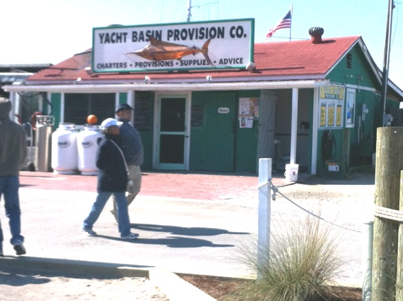
We left the anchorage at Wrightsville Beach at 0745 and continued motoring down the intracoastal. We had the current with us and roared through Snows Cut at about eight knots. It is a darn good thing there are no bascule bridges across Snows Cut, because having to wait on a bridge in that current would be scary. We make great time heading out into the Cape Fear River and face a pretty rough chop as we head down the river. We hoisted the working jib to steady us a bit, but we were very close hauled with a WSW wind. After we made the turn to the west off of Federal Point we dropped the jib because we could not keep it full. The tide had begun to change and the current no longer favored us and it seemed to take a long time to finally turn off the river into the more protected intracoastal channel at Southport. We pulled into the Yacht Basin Provision Company dock to get some lunch and go on a quest to find a boat hook, since my twist lock boat hook no longer locked. We had a great lunch and the people at the Yacht Basin Provision Company were very helpful tying up to their dock. On our quest to find a boat hook we ended up at an auto parts/marine supply store at least 3 miles from the basin. This really surprised me, that there was no place to buy a boat hook near the basin, but we had a good time exploring Southport, and Mary found a coffee shop that sold bagels. She was a happy camper.
We departed Southport around 1400 and made another 13 statute miles to Hewett marine and tied up at 1645. Hewett Marine is no great shakes. It is a boatyard with a few slips right on the intracoastal. When we stopped they were in the process of fixing up the marina and boatyard, and there was no potable water. There was electricity however, and since I carry plenty of water in my tanks, their lack of potable water was not a problem, and they were $1.25 per foot which was considerably less than adjacent marinas. It turns out that they are well located. There are only a couple of relatively poor anchorages between this marina and the Waccamaw River. If you stay in South Port it is a really long day to get to the Waccamaw River for a decent anchorage, from Hewitt Marine, you are three hours ahead of the game.
There was a side benefit to Hewitt Marine. Right next door, there is a local fish market that sells fish caught locally. We walked to the fish market and they were still open, so we bought about 3 pounds of fresh fish. When we got back to the boat, we found that our order had magically doubled. We guessed that someone else’s order had been combined with ours. By this time the fish market was closed, so I left a check under the door for my estimate of the cost of the additional fish. Mary cooked up a great meal of the fresh fish this night and we had enough for another great meal the following evening.
 |
 |
| Entering Southport | At the Yacht Basin Provision Company |
 |
| Leaving Yacht Basin Provision Company and heading into town to look for a boathook |
Day 13, 26 October, 2013, Hewitt Marine to Bucksport Plantation Marina
We were underway at 0815, and continued southwestward down the intracoastal. There are no good anchorages from Hewitt Marine to the Waccamaw River, so we knew that we needed to push a bit. This stretch is narrow with numerous shoals and the infamous “rockpile”. We arrived at the Waccamaw river and proceeded down river to Bucksport where I had planned on anchoring. We arrived in Bucksport at dusk, and rather than try to feel our way into the anchorage, decided to tie up at the Bucksport marina. We tied up at 1630 and settled in for the night. We used this opportunity to do laundry and fill our water tanks. We were expecting nice hot showers, but they apparently turned off the hot water when the restaurant closed, and by the time we were ready for showers we only had cold water. We were connected to shore power so we were able to heat our own water and shower aboard.
 |
 |
| Early morning, leaving Hewitt Marine | Buoy, on the way to Bucksport |
Day 14, 27 October, 2013
Underway at 0820. Leaving Bucksport we had the current with us down to Wynah Bay. We made great time. In Wynah Bay we were able to hoist sail, but the current changed to be against us here. The current had just changed so we still made pretty good time and when we turned south off Wynah Bay we expected the current to be in our favor; this turned out not to be the case due to the current in this part of the intracoastal being significantly behind in time than the currents in Wynah Bay. We originally had thought of stopping in Georgetown, SC, but the reviews we read were not promising, so we pushed on. There are once again few good anchorages on this stretch of intracoastal. At our projected terminus for the day, at McClellanville, there is an anchorage on the east side of the intracoastal in Five Fathom Creek. We were going to anchor there, but decided instead to tie up in McClellanville. This turned out to be fortuitous, because JimBob was able to arrange a ride from McClellanville to Charleston where he could catch the train and make it back to Florida in time to meet with his robotics class. The marina where we stayed in McClellanville was extremely friendly, with clean restrooms and an offer of a ride to the local store. In McClellanville, we met Captain Bill Sloan, of Resolute, the sailing vessel that we had been following south from Wynah Bay. Captain Bill is from Hernando Beach, Fl., just north of Hudson on the west coast of Florida. Imagine the surprise for both of us in meeting someone from our own area. Captain Bill was heading home from a summer spent up north and we were heading to the house we had purchased in Hudson, Fl. More about Captain Bill later.
JimBob did get his ride to Charleston from McClellanville, and Mary and I were on our own.
 |
 |
| Bucksport at Dawn | Down the Waccamaw from Bucksport |
 |
| Down Wynah Bay passing Georgetown. Heading for Mclellanville |
Day 15, 28 October, 2013
Mary and I made sure that Jimbob was sure of his ride; then at 0900, we headed south towards Charleston. There are some good anchorages in Charleston harbor with good holding. The current roars through the harbor, so good holding is essential. I wanted Mary to have a chance to explore Charleston, so if we could find a reasonable place to tie up I was going to do so. Charleston City Marina is a little steep for my blood. The Charleston Maritime Center was $60.00 per night with a Boat US discount and is centrally located near downtown Charleston, so we decided to try it. The entrance to the Charleston Maritime Center is right off the shipping lanes up the Cooper River, so we had to be careful. We tied up at 1525.
Day 16, 29 October, 2013
We Spent the 29th in Charleston, and enjoyed it. Laundry facilities at the marina and a grocery near by the marina, allowed us to be fully stocked and ready to go. We took a self-directed walking tour of the Charleston market, and had a great meal about a mile from the marina.
Without our knowing it, Captain Bill of Resolute had also stopped at the Charleston Maritime Center, and we renewed our acquaintance and talked about our travel plans. The weather was expected to be calm with an east wind 10 to 15 knots until the afternoon of the 31st of October when another front working its way through on the afternoon of the 31st. Neither Captain Bill nor I wanted to fight our way down the winding intracoastal from Charleston to Florida. In this stretch, the intracoastal waterway makes as much east and west as north south. This is a long winding trip through a lot of rivers, marshes and shoals. Both Captain Bill and I decided that if the weather forecast held through the next day, that we would head offshore on the 30th and get as far south as we could, hoping to make it to the St. Mary’s River entrance on the border of Florida and Georgia.
Day 17, 30 October, 2013
We woke to heavy fog on the morning of 30 October. We couldn’t see the Cooper River Bridge from the marina. Captain Bill and I kept waiting for the fog to lift enough to safely head out Charlston harbor. In the meantime, I went to the fuel dock and filled tank 3 with an extra 40 gallons of diesel. At 1000, the fog lifted enough that ship traffic could be seen and avoided, so we departed the Charleston Maritime Center and headed down Charleston harbor and out to sea. The visibility continued to improve as we headed down the harbor so we were feeling pretty confident. In addition we had about a 2 knot current in our favor exiting Charleston harbor. We headed out the main channel to “G15” then headed SSW on a course of 216 degrees true. At midnight we were about 20 miles off of St. Catherine’s Sound, well south of Savannah.
Day 18, 31 October, 2013
We entered the day off St. Catherine’s Sound and by 1000 we were 7.5 nm NW of the buoy off the north Jetty of the entrance into St. Mary’s River. It took us another 5.5 hours to make our way through the inlet and up river to the Fernandina Beach municipal marina at 1325. I was exhausted. They wanted me to maneuver around into the basin but I requested to stay on the face pier since I was very tired and planned on taking off the next morning. I remember Fernandina Beach municipal marina as being quite reasonable 20 years ago. Times have changed. Captain Bill and Resolute had been in company with us from Charleston, and he was single handing. He seemed less tired than I, and I was somewhat surprised at this, I had at least gotten some sleep while Mary relieved me. Captain Bill also tied up at Fernandina Beach, and both of us intending to try to make St. Augustine the next day.
Day 19, 01 November, 2013
Mary and I got underway at 0920 and continued south. We made good time during the morning as we headed south from the St Mary’s River towards the St Johns River. Skipper Bob’s guide warned about the currents as you enter the St Johns River and wow, he was right on about that. We were screaming along with the outgoing tide when we entered the St Johns, made the turn downriver then turned off the river heading south. Staying in the channel as we entered the south bound cut was tricky as we had about a 4 knot cross current. As we entered the cut, we were barely moving. There is a bridge just past the cut entrance and it took an incredibly long time just to get past this first bridge. The intracoastal opens up a bit after passing the bridge and we were able to make a little better progress. We kept pushing and as we approached St. Augustine Captain Bill, who had been travelling along with us decided to anchor. Mary and I decided to push on and made it to St. Augustine Just as darkness was falling and picked up a mooring on the north side of the Lions Bridge in St. Augustine at 1900.
Day 20, 02 November, 2013
We planned on staying in St. Augustine until 05 November, when my friend Dave Howe was taking the train to St. Augustine and would be joining us for the trip around Florida to Hudson. On 02 November we contacted our friend Brendan Burke who lived on Salt Creek in St. Augustine and worked as an underwater archeologist for the Lighthouse museum in St. Augustine. Brendan recommended that we move to the city moorings on Salt Creek, where he could arrange a dinghy landing for us and would put us in close proximity to where he lived and the Lighthouse Museum. It turned out that the mooring that could carry our needed depth of 4.5 feet was not as close as we would have liked but we figured that would not be a problem. It was a long dinghy ride to the place where Brendan had arranged a landing place, but it was not a problem at first. It became a problem as the weather deteriorated.
A little side trip here indicating just how connected we are in our world. I first met Brendan when I visited my stepson at Longwood University in Farmville, Va. A couple of years later, he was the best man at my stepson’s wedding in June 2003. Fast forward a bit. In 2010, I was in Maryland working and keeping my boat at Tall Timbers Marina. At Tall Timbers Marina I met Dave Howe who was very involved in the Institute of Maritime History, (IMH) and we became friends. Dave Howe lent his boat, Roper, to the Lighthouse Museum for a couple of months every year, and Brendan was the skipper for the boat while in use in St. Augustine. What a small world.
Brendan was very welcoming and invited us into his home to take care of things like laundry and loaned us his car for shopping. We were extremely grateful, especially since we were going to be staying in St. Augustine until Dave arrived.
Day 21, 03 November 2013
This day, Brendan made arrangements for a dinghy landing directly opposite the mooring for the Theodore Robert, and this was helpful because the weather had deteriorated a bit, with an east wind blowing 10 to 15 knots. I brought the pieces of the generator exhaust ashore and Brendan took me to the working docks where a friend of his had a shop. The shop had a good vise which allowed me to replace the failed exhaust components for later. While we were at the shop Mary went to the grocery store and we rowed out to the Theodore Robert looking forward to a day as tourists on Sunday, 03 November, 2013.
Day 22, 04 November 2013
Mary and I took this day to explore St. Augustine and enjoyed playing tourist. The two best stops were the Lighthouse Museum and the Alligator Farm. We were not impressed with the tourist traps in St. Augustine proper. We returned to Brendan’s place in the late afternoon, and the wind had picked up even more than the day before. When we went down to the pier where the dinghy was tied up, the waves were breaking over the pier! We decided that going back to the boat was not a big priority, so Brendan and I pulled the dinghy up on the pier and headed back to his place to spend the night ashore.
Day 23, 05 November 2013
Dave was due into the railroad station in Jacksonville today, so I borrowed Brendan’s car and went to Jacksonville to pick him up. After being on the train for something around 24 hours, Dave was beat. Dave and I drove back to St. Augustine where the weather had not improved and Dave was very tired so we stayed ashore again.
Day 24, 06 November 2013
We used this day to do final shopping and get everything together, planning on getting underway tomorrow. This evening we all went out to dinner with Brendan and his friends from work. It was a fun evening. There was a lot of interesting conversations, particularly about under water archeology. I wanted to go aboard the Theodore Robert to be ready to get underway early, but the weather was still bad, and the consensus was to not push it, so we stayed ashore one more day. The Theodore Robert had been happily tied to her mooring for three days without any human companionship and I was getting antsy.
Day 25, 07 November 2013
0700 Underway. We got an early start in spite of spending the night ashore. We did the morning checks while underway to save a little time. Fueled up at the “Inlet Marina” and turned south. We caught the tide and made good time. We anchored at 1700 about 1 nm south of Memorial Bridge in Daytona Beach. Here was the first time I tried to use the generator, and after about 15 minutes, the generator started jumping around like crazy and I shut it down. I looked at it and it looked to me like a shot bearing on the generator; however, when Dave looked at it he thought the black stuff I had seen was belt material. Dave was right. A closer examination showed that the toothed belt had lost half of its teeth causing the “jumping around”. This was good news, if we could find a belt we would be in business. We had no internet so I decided to wait a day and when we next stopped I would check to see where I could find this belt.
Day 26, 08 November 2013
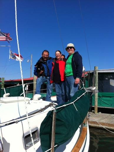
0925 Underway. We had a good run again this day; down through New Smyrna Beach, Mosquito Lagoon, and Haulover Canal to the Titusville municipal marina. We tied up in Titusville at 1700. In Titusville, Dave decided to wash down the decks,(they certainly could use it) and he saw his first manatee as it came to the boat for the fresh water running off the deck. In Titusville, as we tied up to the pier, we noticed a small amount of oil in the water that seemed to be coming from the exhaust of the Theodore Robert. I didn’t worry about it too much, just decided to keep an eye on it to see if it got any worse. I was guessing that it was a little bit of oil blowing by the rings. Here in Titusville we had internet access and I was able to locate the belt on-line but it was an industrial timing belt and there was no way I would be able to pick it up locally. I called my cousin Alan and asked if he could investigate for me, and have a belt shipped to him and I would pick it up when I arrived in North Palm Beach. He was on-line at the time and had the belt ordered while we were still on the phone.
Day 27, 09 November 2013
We got a leisurely start due to waiting for the honey boat for a pump out, and got underway about 1040. After clearing the only bascule bridge (Addison Bridge to Cape Canaveral) we hoisted sail for a good run down the Indian River. The wind was ENE about 10-12 knots. We anchored SE of the Melbourne bridge as close to the causeway as possible. We were able to row ashore to the causeway for Buoy and that made the little black dog pretty happy.
We had Buoy aboard for this whole trip, and one of our big issues was making sure that we had a place to get him ashore if possible. I have still not convinced him that it is OK to urinate or defecate on the boat. I have tried pads, sprays, and even artificial turf, to no avail. If he is desperate he will go, but that is after hours of discomfort. This was one of the reasons for our tying up at marinas more than I would like. Many anchorages do not have a dinghy landing where you can land a pet.
Day 28, 10 November 2013
We started out the 28th day with a worrisome sign. WE were ½ quart low on oil. At this point I am getting pretty concerned but I don’t know what to do about it. We were underway at 0900, then at 1230 we noticed a drop in oil pressure. We had the jib up so and the wind was behind us so we killed the engine and I went below to investigate. There was no oil showing on the dipstick! At this point it was obvious that we could not continue without solving this problem. We hoisted the main, and I added what little oil we had left to the engine. We checked the chart and it looked like our best bet was to sail to Vero Beach and pick up a mooring. In Vero Beach we should have the time to troubleshoot and fix the problem. We hoisted the main sailed the last few miles to Vero Beach. In looking at the manual, the only way I could think of that oil could be getting into the exhaust was through the oil cooler. The plan was to moor at Vero Beach and try to get the necessary parts to bypass the oil cooler thereby stopping the discharge. We succeeded in mooring at 1530 in Vero Beach with a minimal use of the engine and breathed a sigh of relief.
Vero Beach has changed from my youth as being very unfriendly to transients to being a great place to pick up a mooring and stay for a day or two. The Vero Beach Marina, which manages the moorings as well, has a very nice dinghy dock and all of the marina personnel are welcoming and friendly. The Vero Beach Marina is not in the center of things, but there is a bus that will take you to the grocery store and other amenities. It was fortuitous that there was an ACE Hardware about a two mile walk from the marina. It was too late to get to the hardware store the evening of 10 Nov., so we took care of garbage and other shore side needs and planned to get parts and install the bypass after a good night’s sleep.
Day 30, 11 November 2013
We started the day early and I went to the hardware store as soon as it opened. What I needed was a ½ inch flare to flare coupling and two ½ inch flare caps. I purchased these parts, disconnected the oil supply and return from the cooler, connected the supply and return together using the flare to flare coupling and capped the oil connections to the cooler. We started the engine and saw a minimal amount of oil in the exhaust. We figured that this was residual being flushed from the cooler and got underway at 1100. Oil pressure and water temperature looked good, and we raised sail at 1340, turned off the engine and continued south at 6 knots. At 1530 we were getting headed so we started the engine. We dropped sail at 1630 prior to entering the St. Lucie River and heading up into Manatee pocket to anchor. We anchored in Manatee pocket at 1700.
Day 31, 12 November 2013
We were underway at 0928. Heading south towards North Palm Beach where we planned on spending a couple of days and Dawn was driving down from Maryland to join us in North Palm Beach. This was a pretty uneventful day except for the Donald Ross Bridge. The bridge tender would not delay his 1300 opening by three minutes so we had to wait until 1330. Of course the bridge opened late at 1335. So, he wouldn’t delay an opening by three minutes, but on the next opening he was five minutes late! I was pretty hot under the collar at this. I can understand if he was being pressured to only open on schedule, but then by gosh he should open on schedule when someone is waiting! Anyway, we still made it to the North Palm Beach Marina and tied up at 1500.
Day 32, 33, 34: 13 November 2013 through 15 November, 2013
Dawn joined us from Maryland and we spent the next three days in North Palm Beach visiting and doing tourist things. I also picked up the generator belt, (remember the toothless belt?) installed the belt and tested the generator and all was well.
Day 35, 16 November 2013
This was a day of trials; although the outcome was good.
We were underway early at 0707. We noticed a bit of an oil slick from our exhaust as we were leaving the pier. Not very much but puzzling. About an hour and a half later, we realized that we were exhausting quite a bit of oil, so we anchored between Flagler Bridge and Royal Park bridge to investigate. The only thing I could guess now was somehow the transmission cooler was leaking. I checked the transmission fluid and it was totally milky. Uh Oh. Luckily we were still in the West Palm Beach area and I called my niece who drove me to a hardware store, this time to get parts to bypass the transmission cooler and to get replacement transmission fluid. I was able to make the bypass, and we tried to get underway, but due to the Flagler Bridge being under repair all other bridges in the vicinity were operating on very restricted hours. We finally passed through the Royal Park Bridge at 1215, and there was no oil in the exhaust. At this point, Dave and I were both concerned about the transmission overheating. The engine oil is indirectly cooled by the engine coolant system, but the transmission is totally dependent on the cooler and air flow. I was hoping that since automotive transmissions survive without coolers, that the boat transmission would also survive. We continued to the Southern Bridge, which couldn’t open due to electrical problems, so we were hung up here for about 30 minutes. After passing through the Southern Bridge, I checked the transmission temperature by feel and it was really hot. Rather than destroy the transmission I decided to anchor and try to get some help to fix the problem. We anchored at 1358 at statute mile 1023.5 where there were other boats anchored, and there was a little park and a public beach to land the dinghy. Again it was lucky that we hadn’t gotten too far and I was able to call my cousin Alan for some help. He called around and located a 5 inch oil cooler. The cooler was smaller than the original, but I was hopeful that if we didn’t push too hard it would be adequate. Alan generously picked me up on the little beach and drove me to the marine store that had the cooler. I bought the cooler and Alan dropped me off at the little public beach and with my effusive thanks went on to take care of the other plans he had for the day. I returned to the boat and removed the old double cooler and installed the new cooler as a transmission cooler. It was late so we decided to stay at this anchorage for the night. It was not a particularly sheltered anchorage, but it worked well for the night.
Day 36, 17 November 2013
This was a pretty short run, but because we stayed in the intracoastal, it was slow going. Between Lake Worth and Fort Lauderdale, there are bridges almost too numerous to count and they are all on a schedule. It seems like all of the bridges are set up so that if you travel at 8 knots, you will always make the opening of the next bridge. If you travel at 6 knots, you will sometimes make the next bridge and sometimes not. This stretch of the waterway is also known to be full of traffic, narrow and with seawalls on both sides. The wakes bounce back and forth forever. I guess we should have gone on the outside, but due to the various mechanical problems decided to stay inside at least until we were comfortable that all systems were working properly. We anchored at Middle River in Fort Lauderdale, about 2 miles north of the inlet at 1800.
Day 37, 18 November 2013
The anchorage in Middle River is well protected, but due to opposing currents and wind, the boats at anchor did not swing together and we ended up bumping against a catamaran which was anchored close by. Dave said that he would stay up and watch to make sure that we didn’t bump again, but after we both had been up watching for about an hour and the boats not settling down, we decided to get underway. We were underway at 0453.
We went through the 17th St. bridge at 0600 and headed out the Port Everglades inlet. We hoisted sail and headed south towards Biscayne Bay. We were abreast of Miami’s Government Cut inlet at about 1100 and since the weather was calm, decided to stay outside and enter Biscayne Bay through the Biscayne Channel, south of Key Biscayne. That’s a lot of Biscaynes. Biscayne Channel takes you past the old Stilt City, which is a bunch of houses build on stilts in Biscayne Bay, which have all been taken over by the state and are abandoned. Some of them are still in pretty good shape, and others are falling down. After clearing Biscayne Channel we headed south towards Elliot Key, intending to anchor off the Biscayne Park facility so that we could land Buoy. We anchored about 0.6 nm west of the park facility at 1530 in eight feet of water, and used the trolling motor on the dinghy to get us to the park facility. We were astounded when we arrived at the facility to find that it was closed! No explanation, just a closed sign. We landed Buoy anyway, and after he took care of business we returned to the Theodore Robert. This anchorage off Elliot Key is not very well protected from any direction, but is somewhat protected from all directions. Pretty decent anchorage In good weather. I don’t think that I would want to be here in any kind of a blow.
Day 38, 19 November 2013
We got underway from our anchorage off Elliot Key at 0630 and headed south towards Card Sound. We hadn’t decided whether to stay in the Intracoastal Waterway or go outside, south of the keys in Hawk Channel. This was our decision point. There are several channels between keys, from Biscayne Bay to the Hawk Channel until you get to Key Largo. From Key Largo south until Channel Five, west of Lower Matecumbe Key, there is no pass through from the inside passage to the outside passage, at least for a sailboat with a mast of 60 ft. The best marked of the channels south of Key Largo is Angelfish Creek, and we decided that we would be better off outside and entered Hawk Channel from Angelfish Creek at 0905. We had a pleasant day motor sailing southwesterly along the Hawk Channel and picked up a state mooring buoy off Indian Key at 1600. We rowed Buoy ashore and explored Indian Key while Buoy took care of business. The crew discussed whether to continue to Boot Key Harbor in Marathon, or to stay moored at Indian Key. We decided to continue to Boot Key Harbor, where we were going to be met by our friend Sandy. Sandy met us at Red “2” at the sister’s creek entrance to Boot Key Harbor and guided us through sisters creek up Boot Key Harbor where we rafted to “Lady Marilyn”, Sandy’s trawler, for the night.
Day 39, 20 November 2013
The 20th and the 21st of November were spent at a pier that belonged to a friend of Sandy’s in Marathon. I was able to make repairs to the autopilot and Dawn and Mary were able to play tourist for a couple of days in Marathon. On the 21st we took the bus to Key West and were able to see some of the most significant landmarks. I always enjoy Key West.
Day 41, 22 November 2013
We were underway at 0938 heading from Marathon to Charlotte Harbor, across Florida Bay and north along the southwest coast of Florida. We left Boot Key Harbor via the main access channel to the west heading towards the Moser Channel which would take us under the seven mile bridge into Florida Bay. On the way from Boot Key Harbor to Moser Channel there was a veritable mine field of crab/lobster pots. Dave was at the helm when we managed to snag one. We backed down on the engine and appeared to free ourselves, and continued under the seven mile bridge heading for Marker 17 at Bullard Bank. At Marker 17, we hoisted sail and altered course to 337 degrees true, heading towards San Carlos Bay at Ft. Meyers, Fl.
Day 42, 23 November 2013
At midnight starting 23 November, we were underway abeam of Cape Romano and altered course northward to 356 degrees true, to the entrance of San Carlos Bay. At 1330 we anchored off St. James City to land Buoy, since he had not had a chance to go ashore since Marathon. While backing down on the anchor at St. James City, more lobster pot parts popped loose and floated to the surface. We had been making great time under sail while still dragging parts of a lobster pot. We dove the prop here at St. James City and freed the last of the line from the pot that had wrapped around the prop. We raised the anchor at 1440 and continued to a slightly better anchorage behind Useppa Island and anchored for the night at 1800.
Day 43, 24 November 2013
We were underway at 0800 and headed north across Charlotte Harbor and Gasparilla Sound. We cruised north through the intracoastal waterway and exited the waterway into the Gulf of Mexico at the Venice Inlet. The wind was blowing briskly from the northeast which gave us a close reach with an offshore breeze resulting in a minimum seaway with good sailing wind. We couldn’t ask for much more than that. As the afternoon waned, I decided that we would re-enter the ICW at Big Sarasota Pass. This is not a particularly good inlet, but it is well marked and with an offshore breeze and the sun behind us to the west, I felt this was the best bet. The next viable inlet would be at Longboat Pass and by the time we reached that inlet it would be dark. It was a little hairy going through the inlet, but it opened up quickly and we picked up a mooring ball at Marina Jack’s in Sarasota.
Day 44, 25 November 2013
We cast off the mooring at Marina Jack’s at 0810 and headed north up Sarasota Bay. We left the bay and headed up the narrow channel behind Longboat Key, and in the channel behind Longboat Pass, around 1000 we hit a wake and it was “Buoy Overboard!” The channel here couldn’t be more that about 80 feet across, if that with shoals on both sides. I rushed forward and with Dawn’s help, dropped the jib. I left her to secure the jib and ran aft to launch the dinghy from the davits. Dave was at the helm and did a superb job of keeping us in the channel with a blustery east wind while I got in the dinghy to go after Buoy. Buoy swam ashore on Jewfish Key where there was a small muddy beach. I beached the dinghy, grabbed Buoy and started rowing back to the Theodore Robert where Dave was having a time keeping from going aground. As I pulled up to the Theodore Robert Dave got a little distracted by my maneuvering and went gently aground while I was hoisting the dinghy. Luckily we were able to back off the mud and continue on our way. A bit of a scare, but all OK, and we were all grateful that we had kept Buoy in his life jacket while underway. Back underway we entered Tampa Bay from the Intracoastal canal at 1130. The wind was favorable and offshore all day, so in Tampa Bay we hoisted all sail and headed straight across the bay. We scooted across the bay in record time and ducked through the shallow pass off fort DeSoto into the Gulf of Mexico. With the favorable conditions we continued north offshore to the pass just north of Anclote Key. We headed up the Anclote River looking for an anchorage, but there did not seem to be any good anchorages, so we continued up the river to Port Tarpon Marina and tied up at the fuel dock for the night. At 1900.
Day 45, 26 November 2013
The tide at Hudson was going to be low at 1215 on the 26th and we didn’t want to get there on a falling tide so we had a leisurely breakfast at the restaurant at Port Tarpon and got underway at 0910. There was a strong south wind blowing and that aided us until we arrived at the outer buoy of the Hudson channel. The Hudson channel is narrow and shallow and we made our way east very carefully at low speed with a large correction to the south to account for the leeway caused by the south wind. It sometimes seemed that we were 45 degrees to the channel and taking up the whole width. We made it all the way in the main channel, turned south to the condos and hugged the shoreline as we went around the condos to our canal on Beverly Drive. You really need to hug the shoreline and it feels wrong, but the one time I let myself drift a little farther from the shoreline, sure enough I lightly grounded. I gently backed off, and headed closer to shore, (it seemed like I was almost on shore) and made it through. Around the end of the condos it appears to be the shallowest, but we slipped through with the depth finder reading 4 feet, and knowing that the Theodore Robert draws 4 feet 3 inches. (We were going very slowly on an incoming tide so I was not too worried.) We tied up to the dock behind the house at 5925 Beverly Drive, Hudson, Fl. 34667 at 1300 on 26 November, 2014.
| Home Dunedin to Chesapeake Oct., 2008 Hampton to Florida Oct., 2009 Florida to St. Mary's County April, 2010 St. Mary's County to Florida Oct, 2014 Hudson to Bahamas and Back June, 2017 Contact Us |